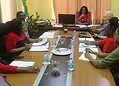
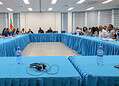
Employees of various ministries attended a training course from 24 to 28 August on the use of geographical, water and climate data. The information is intended to support the government in, among other things, water management, climate adaptation and assessing the risks of flooding and drought.
The Geospatial Data Warehouse & Decision Support System training was organised by the Integraal Waterbeheer department of the ministry of Natuurlijke Hulpbronnen (Ministry of Natural Resources). The Belgian organisation HAEDES BV provided the training within the VIKAP project.
In addition to employees of Natuurlijke Hulpbronnen, representatives of the ministries of Openbare Werken en Ruimtelijke Ordening (Public Works and Spatial Planning) and Landbouw, Veeteelt en Visserij (Agriculture, Livestock and Fisheries) took part.
The training focused on a cloud-based decision support system. This system brings together data on, among other things, rainfall, temperature, river flows and soil moisture. The information can then be processed and analysed to support policy and decision-making.
The system is intended to improve the accessibility and quality of water and climate data. It must also contribute to the monitoring and analysis of hydro-climatological risks, including flooding and periods of drought.
HAEDES also introduced the digital miraX/VIKAP platform during the training. Through this platform, data from monitoring stations, time series and geographical information in the form of GIS maps can be viewed and analysed centrally.
Within the VIKAP project, the data infrastructure is also being used in the development of climate-driven micro-hydropower turbines for sustainable energy supply.
As a follow-up to the training, an inventory will be made of which data are available in Suriname and how these can be connected to digital data warehouses. An assessment will also be made of which additional functions and knowledge the government agencies involved require.